Most "trespass" calls turn out to be one of two very different problems. The first is an actual timber trespass — someone cut timber on the wrong side of a known line. The second is a boundary dispute — the line itself is in question, and the cutting may or may not be a trespass once the line is resolved. They feel similar in the field and they are easy to confuse, but the response, the documentation, and the path forward are not the same.
This Field Note explains how a working forester reads the difference between a timber trespass and a boundary line dispute on Mississippi and Alabama tracts, and what each one means for the landowner. The work belongs to the timber trespass and damage appraisal side of our practice, with broader management questions handled through forestry consulting.
The Working Definition of a Timber Trespass
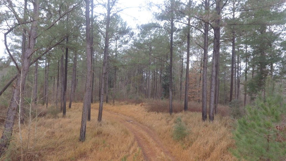
A timber trespass, in plain forestry terms, is the removal or destruction of standing timber on land the cutter had no right to cut. The deeded boundary is not in serious dispute. The cut crosses a recognized line, often by tens or hundreds of feet, and the volume removed is identifiable in the field as belonging to the adjacent owner.
Classic field signs of a working trespass:
- Existing line evidence — old paint, fence remnants, hack marks, prior survey corners — clearly visible on the cut side.
- Stumps that walk past the line by a distance no reasonable crew would attribute to "slop."
- Recent sale activity on the adjacent property where the cut originated.
- Wood that can be traced through scale tickets to a mill, paired with a documented adjacent sale.
The Working Definition of a Boundary Line Dispute
A boundary line dispute is a disagreement about where the legal line actually runs. The cutting may have occurred entirely on what the cutter believed was their own land, based on a fence, a road, or a long-recognized working line. The forestry question is not "did they cross the line?" — it is "where is the line?"
Classic field signs of a boundary dispute rather than a clean trespass:
- The disputed line follows a fence, an old road, or a clearing that has been treated as the boundary for decades.
- Deeds use distance-and-bearing calls or natural monuments that no longer exist.
- Adjacent owners and prior generations all "knew" the line was in different places.
- No survey has been run, or the last survey is decades old and predates current corner monumentation.
This pattern shows up routinely on inherited Mississippi and Alabama tracts. Boundary drift on long-held family ground is the rule, not the exception.
Why The Distinction Matters
The two situations call for different first moves:
- Working trespass: document, freeze the scene, and bring in a forester for a stump cruise. The forestry record needs to be locked while it is still readable.
- Boundary dispute: commission a survey first. Until the deeded line is established on the ground, neither side can credibly claim trespass or defend against it. The forestry cruise still matters, but it follows the survey.
Treating a boundary dispute like a trespass burns goodwill before the line is even established. Treating a clean trespass like a boundary dispute burns the evidence window. The first call to a registered forester usually sorts which one you have.
What a Forester Looks At First
On a first walk-through we look for three things: existing line evidence, the relationship between the cut and that evidence, and the age of the cut.
Old paint that is still visible on the cut side tells us the line was marked and was reasonably findable. Hack marks, fence wire grown into hardwood, and old survey ribbons do the same. When that evidence sits behind the cut by a meaningful distance, the case is shaped like a trespass.
When the existing line evidence is contradictory — a fence one direction, a road another, paint that wanders — the case is shaped like a boundary dispute. The forester documents what is there but recommends a survey before any value work proceeds.
Aerial Imagery Helps With Both
Drone imagery is useful in either case for different reasons. On a working trespass, the flight documents the cut as it sits on a known date. On a boundary dispute, the flight overlays the deed, the working line, and the cut area at one scale so every party is looking at the same picture instead of arguing over verbal descriptions of the woods.
Where the Two Cases Sometimes Overlap
The hardest cases are the ones where both are true at once — the line was unclear and the cutting crossed even the most favorable reading of the boundary. In those cases the work happens in order: survey first, then forestry cruise of the portion that lies on the landowner's deeded land, then a written value opinion. Trying to do all three at the same time produces a record that no one can rely on.
Documentation Timing Still Drives Quality
Even in a boundary case where the survey will take months, the cut itself does not wait. Stumps weather, slash collapses, and species cues fade through the first growing season. We document the scene early — wide photos, stump notes, cut age estimate, GPS points, and an aerial flight — and hold the file until the survey settles the line. That sequence gives the eventual value opinion the strongest possible foundation, regardless of which way the boundary question resolves.
Key Takeaways
- A trespass is a cutting question with a known line; a boundary dispute is a line question with cutting on top of it.
- Existing paint, fences, and prior survey evidence on the cut side usually point toward a trespass.
- Contradictory or missing line evidence usually points toward a boundary dispute that needs a survey.
- Document the field record early either way — the cut keeps weathering while the legal picture catches up.
- Aerial imagery gives every party the same map and shortens the conversation.
Talk With a Forester About Your Situation
If you are not sure whether you are dealing with a trespass, a boundary problem, or both, the first walk-through is what sorts it out. Contact Southeast Forestlands to schedule a trespass and damage appraisal review, or read related forestry case examples in our field case studies.