
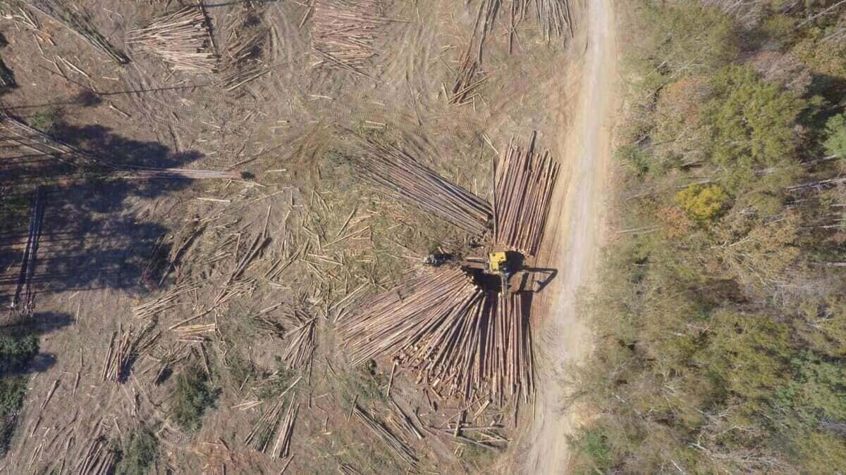
Webster County is north-central Mississippi hill country, just south of the Natchez Trace. Local timber commonly moves into the mill pool around Eupora, Ackerman, West Point, and Starkville, with a steady pole market for the right stands. Terrain rolls through hardwood draws on the lower ground, with loblolly plantation across the upland flats and ridges.
Work with Webster landowners often includes cruises, sale structuring, and reforestation planning. Because the local mill pool is somewhat more concentrated than the deeper southern markets, how a sale is laid out — products separated, access cleaned up, sealed-bid versus negotiated — generally affects pricing more here than in counties with broader buyer competition.
Why Forestry Expertise Matters in Webster County
Webster County timberland varies widely. Soil conditions, access, stand composition, prior management history, tract layout, and proximity to markets can all influence value and feasibility. Some properties may be positioned for harvest but lack proper market exposure. Others may benefit more from thinning, stand improvement, or planning before a sale is put together.
Even within north-central Mississippi, local market conditions can differ. What works for one tract may not apply to another, and a careful read of the specific stand generally produces better decisions than assumptions carried in from a neighboring property.
Without independent guidance, landowners may accept pricing that does not reflect real market demand, miss stronger outcomes because the sale is loosely structured, sign contracts that expose them to unnecessary risk, or experience harvest damage that lowers future productivity.
Example forestry scenario for local landowners. Consider a hypothetical Webster County pine plantation that has been in loblolly through several rotations and is approaching a first-or-second thinning decision. A verbal quote that assumes a specific stocking without a real cruise may not reflect what the stand is currently carrying. A measured basal-area check, and a decision to thin promptly or hold briefly for stand health, can generally produce a stronger long-term outcome than reacting to the timing of an unsolicited offer.
Timber Sales, Appraisals, and Market Representation
A timber sale is often one of the more financially significant decisions a landowner will make. Better outcomes generally come from understanding the tract, reading the market, and structuring the sale deliberately — not from taking the first offer that arrives.
Typical support on a Webster County tract may include:
- Timber evaluation based on species mix, volume, quality, access, and operability
- Professional appraisal to establish fair market value before offers are considered
- Market exposure that brings qualified buyers into competition through a sealed-bid process
- Seller-protective contracts that clearly define responsibilities and safeguards
- Harvest oversight so contract terms are followed once operations begin
The contract is not a formality — it is the landowner's protection. Clear expectations for boundaries, payment, access, wet-weather limits, streamside protection, road use, and cleanup can help prevent problems before they start.
GIS-Driven Tract Review With Field Verification
Accurate decisions generally begin with an accurate understanding of the tract. GIS and mapping tools can be used to evaluate boundaries, access, terrain, soils, and layout efficiently — then verified in the field before recommendations are made.
This approach may help landowners identify operational constraints early, reduce surprises during harvest, select an appropriate timing and sale structure, and protect outcomes through better planning. It is less about walking the property blindly and more about seeing the whole tract clearly before decisions are locked in.
Forest Management Plans and Stand Improvement
Many Webster County landowners are not ready to sell — and in many cases, not selling yet may be the sounder decision. A written forestry management plan can provide direction without pressure, clarifying current stand condition, future potential, and the steps that may improve outcomes over time.
Management planning may include:
- Thinning schedules and stand timing
- Timber stand improvement strategies
- Regeneration and reforestation planning
- Vegetation control programs
- Long-term planning aligned with income, wildlife, recreation, or legacy goals
In many cases, improving stand structure and forest health before a sale may lead to stronger returns and lower operational risk when the harvest is eventually put together.
Reforestation decisions in Webster hill country generally involve matching species, site preparation, and planting density to slope aspect, soils, and drainage. Loblolly on well-drained ridge sites often performs differently from loblolly on wetter draws, and hardwood regeneration may be a stronger fit in some coves and creek bottoms than a straight pine replant. Getting those decisions right at the front of a rotation can materially affect establishment and long-term stand performance.
Boundary Monitoring and Land Protection
Boundary clarity matters on every ownership. Documentation, periodic monitoring, and photo record-keeping can help landowners protect current value and preserve future options. Where unauthorized activity is suspected, timber trespass documentation and condition reporting can provide a professional basis for a claim.
On larger Webster County tracts where boundaries do not follow the ridges, drone-based stand mapping is often the fastest way to see what has grown back since the last cruise.
Regional Context for Webster County Landowners
Timber markets, contractor availability, and hauling economics frequently overlap across county lines. For landowners near county boundaries, reviewing forestry activity and market conditions in Montgomery County may provide useful regional context when evaluating pricing, timing, and sale strategy.
What to Expect When You Reach Out
When a Webster County landowner reaches out, the first step is generally a conversation about the property and what the owner is trying to figure out. That may mean walking or flying the tract and looking at access, SMZs, and stand condition; cruising the merchantable timber so the numbers are real; laying out the options — sell, thin, hold, or replant — with the trade-offs explained plainly; and leaving the decision with the owner.
The goal is not to push a sale. The goal is to help ensure that whatever the landowner decides is decided with the right information, and that the property is protected through whatever comes next.

